Posts

2014 World cup host cities – Belo Horizonte, Brazil

Image
About: Founded in 1897, Belo Horizonte (beautiful horizon) is the capital city of the Brazilian state Minas Gerais. More than 2,4 million people living in Belo Horizonte making it sixth most populous city in Brazil.  Greater Belo Horizonte is the name of the metropolitan area and its home of more than 5 100 000 people. Belo Horizonte is Brazilian first planned city and is the main business tourist destination in the country. Before start to travel to Brazil check my post - 6 things to know, before you travel to Brazil   . Belo Horizonte - Brazil, Foto: Portal da Copa Location Built on several hills and surrounded by mountains, Belo Horizonte is located 430 km / 267 mi, north of Rio de Janeiro. Climate Belo Horizonte has a tropical savannah climate and average temperatures between 9 °C and 35 °C (48 °F and 95 °F). The coldest month is July and the hottest one is January. The summer is rainy and winter is dry. How to get there by air The...

2014 World cup host cities - Brasilia, Brazil

Image
About: Founded in 1960, Brasilia is the federal capital of Brazil. More than 2,5 million people living in Brasilia  making it fourth most populous city in Brazil. The modernist architecture  of the city is listed as UNESCO world heritage site. Before start to travel to Brazil check my post - 6 things to know, before you travel to Brazil . Brazilia - Brasil, Foto: Embratur Location Brasilia is located in the Central Highlands of Brazil, which is in the Central-West part of the country. The city is divided by wide avenues into north and south part. These two parts are divided in numbered superblocks and sectors. There are sectors for specified activities as: Hotel sectors (Setor Hoteleiro)  Embassies sector (Setor de Embaixadas) Commercial sectors (Setor Comercial)  Residential sectors (Superquadras)  Local commerce sectors (Comércio Local).   Climate Brasilia has a tropical savannah climate and temperatures, which varies depe...

2014 World cup host cities - Curitiba, Brazil

Image
About: Curitiba is the capital of the Brazilian state Paraná, which is located in the southern part of Brazil. The city was founded in 1693 and 1,8 million people live there nowadays.  The population is formed mainly by European emigrants from Russia, Germany, Ukraine, Poland and Italy. Before start to travel to Brazil check my post - 6 things to know, before you travel to Brazil . Curitiba - Brazil, Foto: Portal da Copa Location Curitiba is situated in south part of Brazil at about  105 km (65 mi) west of the Atlantic Ocean and sits on a plateau at 932 m (3000 ft.) above sea level. The city occupies an area of 432 sq. km. (166 sq. mi.). Climate Curitiba has a subtropical climate, but because of the altitude of almost 1000 meters above the sea level, an average minimum temperature during the winter (June-September) is 7 °C (45 °F) and sometimes falling even below 0 °C (32 °F). In the summer (December-March) temperatures could reach of maximum through 30...

2014 World cup host cities - Fortaleza, Brazil

Image
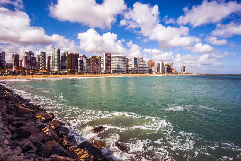
About: With population of about 2,5 million people Fortaleza is the capital city of the Brazilian state Ceará. Located in Northeastern part of Brazil, Fortaleza is the fifth largest city in the country.  Discovered in 1500 and founded as a village in 1726, Fortaleza is one of the popular tourist destinations with its 34 km/ 21 mi of wonderful beaches. Before start to travel to Brazil check my post - 6 things to know, before you travel to Brazil . Fortaleza - Brazil, Foto: Portal da Copa Location Fortaleza is situated in the north-east part of Brazil, on the Atlantic Ocean coast and occupies an area of 313 sq. km. (121 sq. mi.). Climate Fortaleza has a tropical climate and average temperatures of 23º C / 73 °F - 31º C / 88 °F. The rainy season is from February to May and the dry one, between July and December. How to get there by air Pinto Martins International Airport is located just 8 km /5 mi from the city center. The taxi to the center will cost you...

2014 World cup host cities - Manaus, Brazil

Image
About: Manaus is the capital of the biggest Brazilian state Amazonas. Founded in 1693, the city has population of about 2 million people. Amazonas is one of the foremost far-famed places on the earth as a result of its within the middle of the world’s biggest woodland. The state is larger than France and Spain put together.  Before start to travel to Brazil check my post - 6 things to know, before you travel to Brazil . Manuas - Brazil, Foto: Portal da Copa Location Manaus is situated in the north part of Brazil, where the Negro meets the Amazon river (also known as Solimões) in the middle of the Amazon rainforest. Manaus occupies an area of 11 sq. km. (4 sq. mi.), while the Amazonas state is 1.5 million sq. km. (579 238 sq. mi.). Climate Manaus has an equatorial climate and average temperatures of 28º C / 82 °F and air humidity of over 80 %. The rainy season is from December to May and the dry one, between June and November. How to get there Access to Manaus is ma...

2014 World cup host cities - Natal, Brazil

Image
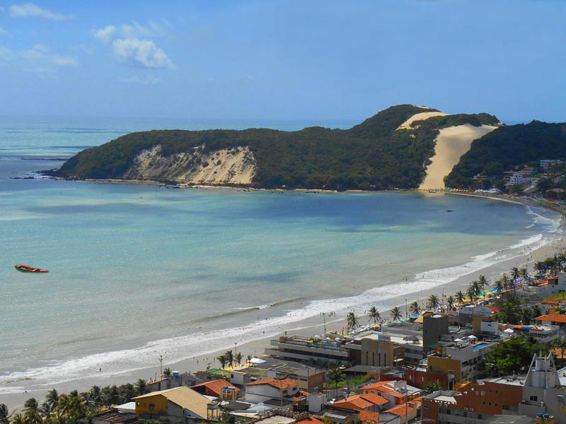
About: Founded in 1599, Natal is the capital city of the Brazilian state Rio Grande do Norte. With its population of more than 800,000 people, the city is one of the major tourist destinations in Brazil. Natal with its amazing beaches, is becoming more and more popular among Brazilian and international tourists. It is a fact that Natal is one of the Brazilian cities nearest Europe and North America. Natal, Brazil Before start to travel to Brazil check my post - 6 things to know, before you travel to Brazil  Location Natal is situated, where Potengi River disgorges its waters into the Atlantic Ocean. The city is divided into four areas – South (tourist area), North (industrial area), East (Natal’s historical center and major sights) and West and occupies an area of 179 sq km (65 sq mi). Climate Natal is known as the Sun City, because of tropical climate and annual average temperatures of 28º C / 82 °F. People who live here, enjoy 300 sunny days a year. How to...

2014 World cup host cities - Porto Alegre, Brazil

Image
About: Founded in 1769 by Manuel Sepúlveda, Porto Alegre is the capital of the Brazilian state Rio Grande do Sul. Population is about 1, 5 million people (4,5 million – metropolitan area) and the majority is formed by European emigrants, which came In the late 19th century. The city is also one of the richest in Brazil. Most of the people who live in Rio Grande do Sul consider themselves as gauchos rather than Brazilians.. Porto Alegre  Before start to travel to Brazil check my post - 6 things to know, before you travel to Brazil . Location Porto Alegre is situated on the eastern bank of the Rio Guaiba, where 5 rivers converge and infuse in the lake, forming a delta. Rio Guiba is connected to the Lagoa dos Patos, which is a fresh water lagoon. It is not a problem even for big ships, coming from the Atlantic Ocean to dock at the port. Climate Porto Alegre has a humid subtropical climate. It is very muggy in the summer, because of high levels of humidity and tem...